Data
The community of Kotzebue sits alongside the northeastern shore of the Kotzebue Sound, at the mouth of Kobuk Lake (Hotham Inlet) and the Noatak River.. The surrounding waterways vary significantly in their physical, chemical, and biological characteristics (Whiting 2011). Sampling sites near the community were selected with primary guidance from Alex Whiting, the Environmental Program Director of the Native Village of Kotzebue, based on his knowledge of local ecology. A map of Kotzebue and its surrounding waterways is shown below.

Water column measurements and water samples have so far been collected over several late summer and early fall trips to Kotzebue in 2019, 2021, 2022, and 2023. Measurements are collected with a YSI EXO-2 sonde, which is a collection of sensors that measure temperature, salinity, turbidity, oxygen, dissolved organic matter (fDOM), phytoplankton fluorescence (chlorophyll-a and phycocyanin), depth, and pressure. Water samples from these same locations are preserved and sub-samples will be used for phytoplankton cell counts done by Professor Ed Carpenter at San Francisco State University.
The following chart provides a brief overview of some of the key measurements and what they may indicate.
Mooring data from Kobuk Lake is organized below by date and location.
In the summer, continuous surface water measurements of temperature, salinity, turbidity, oxygen, dissolved organic matter (fDOM), phytoplankton fluorescence (chlorophyll-a and phycocyanin), depth, and pressure are collected every 10 minutes on a mooring in Kobuk Lake.
Hourly mooring data from the summer are displayed below.
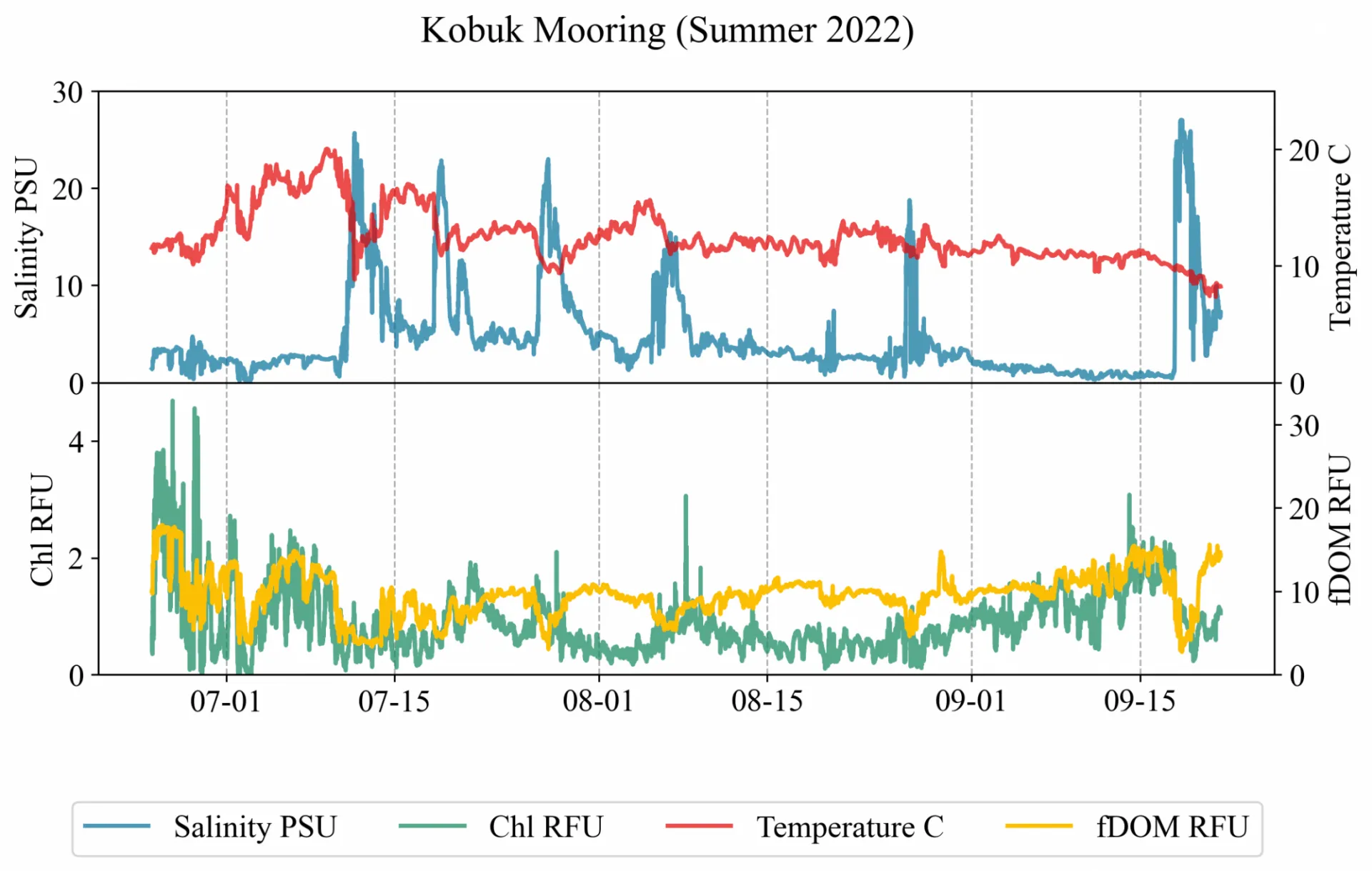
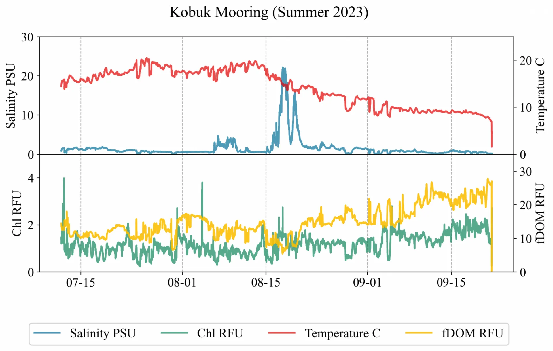
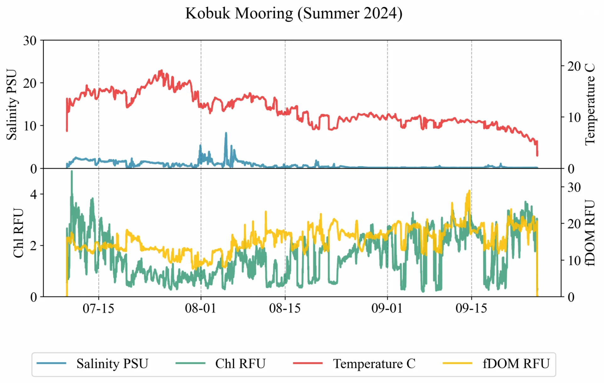
Data organized by location are displayed below.